
AN Arctic blast is set to hit Wales this weekend, with the weather set to 'turn chillier'.
The Met Office is warning that it is going to feel much colder with the chance of some hill snow by the end of the week.
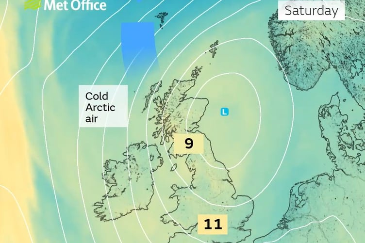
The wind direction is set to change, bringing Arctic air across the United Kingdom by Friday, with temperatures expected to be 'below normal' over the weekend and into next week.


The weather on Tuesday will brighten throughout the day, with most places staying dry and a maximum temperature of 15 °C.
Wednesday will be often cloudy with outbreaks of rain, especially in the north through the morning before becoming patchier through the day.
Remaining mild with light winds. Maximum temperature 14 °C.
Largely dry to start on Thursday with rain and drizzle arriving later. Sunny spells and blustery scattered showers on Friday and Saturday, these heavy at times and turning chillier.
Then from Saturday, the Met Office says: "Sunny spells and showers across the UK on Saturday. "The showers will heavy and thundery at times, perhaps with hail in places.
"The showers are expected to gradually die out from the northwest later in the day, with most places dry by the evening.
"Mainly dry Sunday morning with sunny spells before cloud increases from the west later, some rain probably reaching western areas later in the day. Temperatures are expected to be below normal over the weekend.
"Into the following week, unsettled conditions will likely develop across many parts with Atlantic frontal systems spreading in from the west.
"All areas will see periods of wet weather, with some drier spells in-between.
"Rainfall amounts will probably be highest in the south, with northern areas slightly drier but cooler."
Comments
This article has no comments yet. Be the first to leave a comment.